












A group of runners in Iceland has completed the equivalent height of Mount Everest — 8,849 metres — by repeatedly ascending and descending Esja, the iconic table mountain that looms over Reykjavík, in a single continuous effort. The Esja Everest challenge has gone viral in Iceland and internationally, drawing attention from hikers and adventure travellers searching for their next extreme outing.
Key takeaways
- Runners completed the height of Everest (8,849 m) by repeating laps on Esja, the mountain above Reykjavík.
- Each return trip to Esja’s main summit plateau gains roughly 650–700 metres of elevation, meaning participants needed approximately 13 full ascents.
- The challenge was completed in a single continuous push lasting well over 24 hours, according to reports in Morgunblaðið and Iceland Monitor.
- Esja is a well-maintained, publicly accessible mountain with a staffed hut at the trailhead — tourists can and do attempt multiple laps.
- The feat highlights Esja’s growing reputation as one of Europe’s most accessible high-repetition endurance venues.
How did runners complete the height of Everest on Esja mountain in Iceland?
The concept is simple but brutal. Instead of flying to Nepal, the participants drove — or jogged — to the Esjurætur trailhead car park at the base of Esja, roughly 10 kilometres north of central Reykjavík along Route 1. From there, they repeated the well-worn trail to the upper plateau, turned around, descended, and started again. And again. And again.

Each ascent follows the main marked path from the car park to Þverfellshorn, the most commonly reached high point on Esja at approximately 780 metres above sea level. Because the trailhead sits close to sea level, each return lap delivers close to 650–700 metres of vertical gain. Runners accumulated those metres across the full height of Everest — 8,849 metres — without a single aeroplane ticket.
The technique is known internationally as Everesting: picking any hill, climbing and descending it repeatedly until the total elevation gain matches Everest’s summit height. Iceland’s version, using Esja, is a natural fit. The mountain’s path is wide, well-signed, and open around the clock, and during Iceland’s summer the midnight sun means there is no darkness to contend with. Conditions during the attempt were reported as clear and dry — ideal by Icelandic standards.
How many times do you need to climb Esja to equal Everest’s height?
The exact number depends on which route and which high point participants use, but the working figure is approximately 13 full return ascents using the standard path to Þverfellshorn. Here is how the maths breaks down:
- Everest height: 8,849 metres
- Elevation gain per Esja lap (trailhead to Þverfellshorn and back to base): approximately 650–700 metres
- Laps required at 650 m gain: roughly 13.6 — so participants typically aim for 14 full laps to be certain of clearing the target
- Total distance covered: each lap is approximately 5–6 kilometres return, putting total distance somewhere around 70–80 kilometres
Some participants choose to extend to the higher and more technical Kerhólakambur ridge at around 850 metres, which would reduce the lap count slightly but makes the terrain considerably more demanding, especially in wet conditions.
Who organised the Esja Everest challenge and how long did it take?
Reports in both Morgunblaðið, Iceland’s oldest daily newspaper, and Iceland Monitor, the English-language news outlet with strong international readership, covered the challenge simultaneously. Based on those reports, the event was organised as a team-based endurance record attempt rather than a solo effort, with runners supporting each other through the night laps. The full challenge took well over 24 hours of continuous movement to complete.
Specific organiser names and exact finishing times had not been fully confirmed across all sources at the time of publication. Iceland Now will update this article as further details emerge. What is confirmed is that the attempt was completed successfully and that it has sparked significant public interest — both among Icelandic running clubs and among international Everesting enthusiasts who follow the global Everesting Hall of Fame, the official register of verified Everesting completions worldwide.
Can tourists attempt multiple ascents of Esja in one day?
Yes — and many already do. Esja is one of the most accessible mountains in Iceland for independent visitors. There is no permit required, no entrance fee, and no guide is mandatory. The trailhead at Esjurætur includes a staffed mountain hut run by the Ferðafélag Íslands (Icelandic Touring Association), where hikers can buy coffee, soup, and snacks, and use toilet facilities. The hut is typically open during daylight hours in summer.
Practically speaking, a fit, experienced hiker could complete two or three laps of Esja in a long summer day with relative comfort. Attempting the full Everesting challenge — 13 or more laps — is an extreme endurance endeavour that requires serious preparation:
- Train specifically for high-volume vertical gain, not just horizontal distance.
- Carry sufficient food and fluid for 20–30-plus hours of effort.
- Register your attempt with the Everesting platform if you want an official record.
- Check the weather forecast with Veðurstofa Íslands (the Icelandic Meteorological Office) at vedur.is before you start — Esja can shift from sunshine to whiteout in under an hour.
- Tell someone your plan and expected return time.
- Wear trail running shoes or sturdy hiking boots; the upper section becomes loose scree and can be icy outside summer.
Rental cars make the trailhead easy to reach from Reykjavík in about 15 minutes. There is also bus service from the capital during summer months, though timing for multiple laps would require a vehicle.
How hard is it to hike Esja and what is the elevation gain per lap?
Esja is graded as a moderate hike for the standard route to Þverfellshorn. Most reasonably fit adults complete a single ascent and descent in two to three hours. The path starts gently through birch scrub and grassland before steepening sharply above the 400-metre mark, finishing on a rocky ridge with chain-assisted scrambling near the top.
The elevation gain per standard lap is approximately 650 to 700 metres, starting from the Esjurætur car park at roughly 60–80 metres above sea level. The surface is well maintained on the lower half but rougher above. In summer, the trail is snow-free and dry for most of its length. In winter and early spring, crampons and an ice axe may be needed for the upper section.
For runners targeting the Esja Everest challenge specifically, the repetition itself — not the individual lap — is the true difficulty. Leg muscles that handle one ascent easily begin to fail on laps seven, eight, and nine. Experienced Everesting athletes recommend slowing deliberately from the first lap to preserve muscle function for the later hours.
Why Esja and why now?
Esja has always been Reykjavík’s backyard mountain. On any clear afternoon, its distinctive flat-topped silhouette dominates the northern skyline from the city’s waterfront at Harpa concert hall and from the residential streets of Grafarvogur. Locals hike it year-round; Reykjavík’s running community uses its trails as standard training terrain.
But the Everesting movement — which began in Australia in 2014 and now has thousands of verified completions globally — has given Esja a new kind of international identity. The mountain’s consistent gradient, reliable trail surface, and 24-hour summer daylight make it one of the best Everesting venues in northern Europe. This challenge, covered simultaneously by Iceland’s two most-read news platforms, has now brought that fact to a global audience at exactly the moment adventure travel searches are peaking for summer.
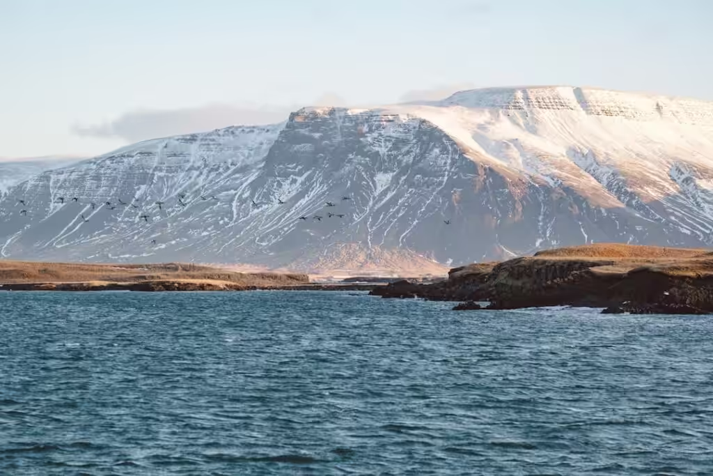
For travellers already planning a trip to Iceland, the timing is ideal. Esja is at its best from June through September, when the trail is clear, the hut is staffed, and the long daylight hours make multi-lap attempts genuinely feasible without head torches or cold-weather gear.
Frequently asked questions
Where exactly is the Esja trailhead and how do I get there from Reykjavík?
The main trailhead, called Esjurætur, sits on the southern shore of Hvalfjörður — technically just north of the Reykjavík Capital Region boundary, roughly 10–15 kilometres from central Reykjavík via Route 1 north and then Route 36. By car the drive takes about 15 minutes from downtown. A summer bus service also connects the city to the trailhead, but check current schedules with Strætó as times vary by season.
Is the Esja Everest challenge an official registered record?
The global Everesting platform at everesting.cc maintains an official Hall of Fame for verified completions. To receive an official listing, participants must use a GPS device to record every metre of their attempt and submit the data for verification. Without that submission, a completion is personal but not officially recognised. Reports of this particular Icelandic challenge are still emerging, so verification status had not been confirmed at time of publication.
What should I pack for multiple Esja laps?
For two or three laps, bring at least two litres of water (refillable at the hut), high-calorie snacks, a wind layer, and trail shoes with grip. For a full Everesting attempt, plan for 24-plus hours: expect to need 6,000–8,000 calories, multiple clothing layers, a head torch, trekking poles, and blister-prevention tape. The hut sells basic food and drinks but should not be your only supply source for an endurance attempt.
How long does a single Esja hike take?
A fit adult typically takes 45–75 minutes to reach Þverfellshorn from the trailhead and 30–50 minutes to descend, giving a round-trip time of 1.5 to 2.5 hours at a comfortable walking pace. Runners in good condition can complete a lap in under 60 minutes total. Conditions, fitness level, and trail crowds in peak summer all affect timing.
Is Esja safe in all weather conditions?
The lower slopes are safe in most conditions, but the upper ridge and Þverfellshorn area can become dangerous in high winds, rain, or ice. Always check the forecast on vedur.is before heading up. Winds above 15–20 metres per second make the exposed upper section hazardous, and the Icelandic Met Office issues mountain warnings that hikers should take seriously.