













Another rescue operation has been carried out at Hrafntinnusker, the high-altitude waypoint on the Laugavegur trail in Iceland’s southern highlands, as emergency teams respond to a fresh incident at one of the country’s most reliably hazardous hiking locations. The situation underscores mounting concern about hiker safety on a route that draws tens of thousands of visitors each summer.
Key takeaways
- A new rescue has been carried out at Hrafntinnusker on the Laugavegur trail — one of several this season.
- Conditions at the 1,128-metre waypoint can change without warning, even in summer.
- The Laugavegur trail is open but demands serious preparation — this is not a casual day hike.
- Hikers in trouble should call 112, Iceland’s emergency number, or use the 112 Iceland app.
- Check forecasts at Veðurstofa Íslands (Icelandic Met Office) before setting out.
What happened in the latest Hrafntinnusker rescue?
Search and rescue teams — known in Iceland as björgunarsveit — were called to Hrafntinnusker following reports of hikers in distress on the trail. The exact circumstances of the latest incident have not been fully confirmed by officials at the time of publication, but the call-out follows a pattern of emergencies at this specific location that has persisted throughout the 2025 hiking season. Rescue teams from the Icelandic Association for Search and Rescue (ICE-SAR) routinely respond to incidents in this area.
Hrafntinnusker sits at roughly 1,128 metres above sea level, making it the highest overnight hut on the Laugavegur route. The hut is operated by Ferðafélag Íslands (the Iceland Touring Association) and lies approximately 12 kilometres from the trailhead at Landmannalaugar. At that elevation, conditions deteriorate rapidly and without much notice.
How many rescues have happened at Hrafntinnusker this season?
Multiple rescue operations have been recorded at or near Hrafntinnusker during the 2025 summer season. While ICE-SAR does not always publish a running tally for individual waypoints, the clustering of incidents at this location in a short window has drawn attention from both Icelandic media and international hiking communities. Rescue professionals have repeatedly stated that Hrafntinnusker accounts for a disproportionate share of highland call-outs each season.
The pattern is not new. Year after year, hikers underestimate the demands of the section between Landmannalaugar and Hrafntinnusker — and the exposed plateau above the hut itself. Still, the frequency so far in 2025 has been notable.
Is the Laugavegur trail safe to hike right now?
The trail is open. However, open does not mean easy or risk-free. The Laugavegur — a 55-kilometre route running from Landmannalaugar south to Þórsmörk — is one of the most iconic multi-day hikes in Europe, but it crosses genuine wilderness terrain with no road access and rapidly changing weather.
Conditions at Hrafntinnusker in particular can shift from calm sunshine to near-whiteout in under an hour. Snow patches persist on the plateau well into July most years. River crossings elsewhere on the route can be dangerous after rainfall. ICE-SAR and the Icelandic Met Office have both urged hikers to treat this trail with the same respect as any high-alpine route.
The trail is safest for those who:
- Have prior multi-day hiking experience in variable mountain conditions.
- Carry full waterproofs, insulating layers, and a map — not just a phone.
- Book huts or campsites in advance through Ferðafélag Íslands or Highland Center.
- Check the Veðurstofa Íslands forecast the morning of each day’s hike.
- Register their trip at safetravel.is before departing.
What are the current conditions around Hrafntinnusker?
Conditions in the Icelandic highlands shift daily and sometimes hourly. As of the time of writing, the plateau around Hrafntinnusker remains subject to the same unpredictable weather systems that have triggered recent rescues. Summer 2025 has brought a mix of warm spells and sharp cold fronts to the interior, with wind and visibility the primary hazards at altitude.
For the most current and reliable forecast specifically for the highlands, hikers should use the Icelandic Met Office’s English-language forecast portal, which provides mountain and highland forecasts updated several times daily. The Hrafntinnusker hut wardens also share real-time conditions updates when reachable.
Snow on the trail above 900 metres is common even in late June. Crampons or microspikes are recommended for early-season hikers. By mid-July most snow has melted at lower elevations, but the plateau directly around Hrafntinnusker typically retains patches through the month.
What should hikers do if they get into trouble on the highland trail?
If you or someone in your group is in danger on the Laugavegur trail, act immediately. Do not wait and hope conditions improve.
- Call 112. Iceland’s emergency number connects directly to a coordination centre that can dispatch ICE-SAR teams to your location.
- Use the 112 Iceland app. The free app, available on iOS and Android, sends your GPS coordinates directly to emergency services — critical when you cannot describe your location verbally.
- Stay put if visibility is poor. Moving in low visibility increases the risk of injury. Find shelter, put on every layer you have, and wait for rescue if conditions are dangerous.
- Use the emergency huts. The Laugavegur route has orange emergency shelters at intervals. These are not for comfort stops — they are for genuine emergencies only, but they provide shelter while you wait for help.
- Alert the hut warden. If you are near Hrafntinnusker hut, the warden has communication equipment and can coordinate with rescue teams faster than a solo call.
ICE-SAR volunteers give their time freely to save lives on these mountains. The organisation asks hikers to be honest about their fitness level before setting out, and to turn back if conditions change — there is no shame in it, and it saves lives.
Why Hrafntinnusker is a recurring flashpoint
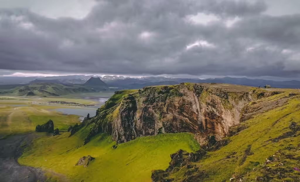
The geography explains much of the danger. Hrafntinnusker — whose name translates roughly as “obsidian rock spit” — sits on an exposed rhyolite plateau in the Fjallabak Nature Reserve. There are few natural windbreaks. The terrain is stark and disorienting in poor visibility, with the obsidian lava fields and snowfields blending into a monochromatic landscape that can confuse even experienced hikers.
Tourism on the Laugavegur has grown sharply in recent years. The trail now requires advance booking during peak season, and Ferðafélag Íslands has introduced mandatory hut reservations to manage numbers. But demand continues to draw hikers who may lack the experience the route requires. That mismatch — between the trail’s international fame and its genuine physical demands — is a central reason rescue teams return to Hrafntinnusker season after season.
For anyone planning the Laugavegur in 2025, the current rescue activity is not a reason to cancel — but it is a clear signal to prepare properly, check conditions daily, and register your journey before you leave the road behind.
Frequently asked questions
Where exactly is Hrafntinnusker on the Laugavegur trail?
Hrafntinnusker is the first overnight stop on the Laugavegur trail heading south from Landmannalaugar, approximately 12 kilometres from the trailhead. It sits at around 1,128 metres above sea level on an exposed plateau in the Fjallabak Nature Reserve. It is the highest hut on the entire route and the section most exposed to sudden weather changes.
Do I need a permit to hike the Laugavegur trail?
There is no formal hiking permit for the Laugavegur trail itself, but hut and campsite bookings are mandatory during the peak season (roughly mid-June to mid-September) and must be made in advance through Ferðafélag Íslands or the Highland Center at Hrauneyjar. Walk-in space is extremely limited and cannot be relied upon. Registering your trip at safetravel.is is strongly recommended though not legally required.
What is ICE-SAR and who pays for a rescue in Iceland?
ICE-SAR (Slysavarnafélagið Landsbjörg) is Iceland’s primary search and rescue organisation, made up almost entirely of trained volunteers. Rescue operations in Iceland are free of charge to those rescued — there is no bill sent afterward, unlike in some other countries. The organisation is funded through public donations and state support. Hikers are encouraged to donate to ICE-SAR to help sustain the service.
When is the best time to hike Laugavegur to avoid the worst conditions at Hrafntinnusker?
Late July to mid-August generally offers the most stable conditions on the Laugavegur, with the lowest chance of snow on the Hrafntinnusker plateau and the most daylight. However, no window guarantees good weather in the Icelandic highlands. Early-season hikers (June and early July) should carry microspikes and expect possible trail closures after heavy snowfall.
How do I check conditions on the Laugavegur trail before I go?
The most reliable source is the Icelandic Met Office (Veðurstofa Íslands) at en.vedur.is, which publishes highland-specific forecasts updated multiple times daily. Ferðafélag Íslands posts trail condition updates on its website and social media channels. The 112 Iceland app also carries safety alerts. Always check the morning of each hiking day, not just before you travel to Iceland.