


Crochet Volcano
Photo by Tom Podmore
Few volcanoes carry a reputation quite like Hekla. For centuries, Icelanders have called it “the entry to hell” — and it’s hard to argue with the name when you’re standing in its shadow. This brooding mountain has long been cast as a portal to the underworld, stirring equal parts dread and fascination among those who live within range of its slopes.
Medieval Icelanders treated Hekla as a bad omen, and that reputation spread far beyond Iceland’s shores. It found its way into works like Herman Melville’s *Moby Dick*, William Blake’s poem “Winter,” and the Icelandic Symphony, Hekla OP 52, a composition known for its thunderous power.
Since the island was first settled around 870 AD, Hekla has erupted over twenty times, each event reshaping the surrounding landscape and reminding locals that the next one is never far off.
The most recent eruption came at the dawn of the new millennium in 2000, a fiery reminder that the volcano hasn’t finished with us yet.
Between eruptions, though, Hekla is a completely different beast. Hikers and mountaineers work their way up its trails in warmer months, while winter brings skiers and snowmobilers out onto its slopes.
Hekla isn’t just a volcano you watch nervously from a distance. When it’s quiet, it’s one of the more rewarding places to explore on foot — slopes, silence, and a landscape that feels like it’s still being made.
Kerlingarfjöll Mountains
The Kerlingarfjöll range covers 367 square kilometers in the Interior Central Highlands. Its main draw is Hveradalir, the third-largest geothermal area in the region — a churning, steaming landscape where the dark, rust-coloured rhyolite rock tells the story of a violently volcanic past.
The colours here are remarkable. Earthy reds, burnt oranges and streaks of yellow cut across the hillsides, all of it shaped by heat still moving beneath the surface.
Kerlingarfjöll once had the distinction of being Iceland’s top summer ski resort, but ski operations shut down in 2000 as rising temperatures made reliable snowfall increasingly rare. The area now operates as a Highlands Resort, offering food and accommodation to visitors who come for the scenery and the geothermal activity.
The hike to Hveradalir’s hot springs is well worth the effort. Setting off from the Kerlingarfjöll resort, the trail covers a gentle 4 kilometers (2.5 miles) through open Highland terrain. You won’t need crampons, but good hiking shoes and walking poles make the going easier.
The route isn’t marked, but it’s easy enough to follow. When you get there, the geothermal area opens up in front of you — vents hissing, pools glowing in strange colours, the Kerlingarfjöll mountains framing the whole scene. For anyone who’d rather skip the hike, a 10-15 minute drive from the resort will get you to Hveradalir.
In March 2017, it was announced that this mountain range would receive the status of an officially protected Nature Reserve — a significant win for those who had been fighting plans to exploit the area’s geothermal energy for new power plants.
For more insights into the challenges facing Icelandic nature, explore our pieces on Sustainable Tourism in Iceland and Rivers for Sale | The Future of Iceland’s Water Systems.
Hveravellir Nature Reserve
Hveravellir is often described as one of the last great wilderness reserves on Earth, and it earns that reputation. The name translates to “Hot Spring Fields,” which sums up the place well enough — though nothing quite prepares you for the reality of it. It sits between the Langjökull and Hofsjökull glaciers, a Highland oasis that feels genuinely remote.
Running through it is a route known as Kjalvegur, which dates back to 900 AD, one of those quiet reminders that Icelanders have been crossing this raw interior for over a thousand years.
As one of the country’s largest geothermal areas, Hveravellir is packed with hot springs — some perfectly sized for a soak, others best admired from a safe distance.
For sheer geothermal spectacle, very few places in Iceland come close to Hveravellir. Haukadalur might rival it, but that’s about it.
The springs here have names worth knowing: the “Blue Hot Spring” (Bláihver), the “Green Hot Spring” (Grænihver), the “Red Hot Spring” (Rauðihver), the “Beautiful Hot Spring” (Fagrihver), and the “Old Beautiful Hot Spring” (Gamli Fagrihver) — all within the same stunning area.
Photo by Regína Hrönn Ragnarsdóttir
The first detailed written accounts of Hveravellir date to 1752, recorded by travelers Eggert Ólafsson and Bjarni Pálsson. They gave one of the hot springs its name — Öskurhóll, or “The Roaring Mound” — because of its distinctive whistling sound.
Photo by Regína Hrönn Ragnarsdóttir
Right next to the visitor’s center, there’s a hot pool with temperatures ranging from 8 to 39 degrees Celsius — a genuinely pleasant place to stop and sit for a while. One caveat: stay well clear of the input pipe, which runs scalding hot. As for changing facilities, well — this is Iceland.
Hveravellir sits on the edge of a lava field, about an hour’s drive from the Kerlingarfjöll mountains. It’s one of the more accessible spots in the Highlands for anyone wanting to feel the forces that built this island firsthand.
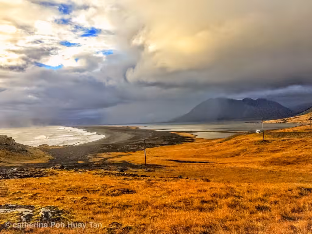
Langisjór Lake
Getting to Langisjór is no small feat. But those who make the effort find one of Iceland’s most beautiful lakes — hemmed in by mountains on all sides, with green hillsides dropping steeply to the water.
Come prepared, and Langisjór will reward you. It’s one of the Central Highlands’ genuine hidden gems.
The lake covers 26 square kilometers, stretching 20 kilometers in length and 2 kilometers wide, with a maximum depth of 75 meters. It runs along the southwestern edge of Vatnajökull National Park.
In recent years, environmental groups have raised serious concerns over government proposals to build an industrial dam on the lake. Its remoteness, rather than protecting it, has actually made it a target — easier to justify development when few people witness the consequences. Activists argue that trading Iceland’s wilderness for industrial expansion cuts against something fundamental about this country.
Bardarbunga Volcano
Buried under the Vatnajökull glacier, Bardarbunga was largely unknown outside scientific circles until fairly recently — which is surprising, given that it holds the title of the second-largest mountain in Iceland. Being hidden under kilometres of ice will do that to a volcano’s public profile.
That changed in August 2014, when Bardarbunga erupted in spectacular fashion. The eruption ran for six months, ending on February 27, 2015. It also reshuffled the science: subsequent studies found layers of tephra that had previously been attributed to a nearby volcano were, in fact, from Bardarbunga.
The landscape around the site today carries the marks of that eruption clearly — a raw, otherworldly terrain that’s still settling into itself. Access is difficult, and visitor numbers remain very low, which only adds to the sense that you’re somewhere few people ever get to see.
Did you enjoy our exploration of the Icelandic Central Highlands? Whether you’re dreaming of your next destination or reminisce about past adventures, we’d love to hear from you. Share your thoughts and experiences in the comments section below.


