













The latest Iceland eruption has ended, with clear skies now reported over the Westman Islands — known in Icelandic as Vestmannaeyjar — marking a significant pause in volcanic activity in the area. Morgunblaðið, Iceland’s largest daily newspaper, reported the development, confirming that residents and visitors can now see bright, unobstructed skies where ash and volcanic haze had previously dominated.
Key takeaways
- Volcanic activity near the Westman Islands has ceased, with clear skies confirmed over the area.
- The eruption is over, but Icelandic authorities have not issued an all-clear for unrestricted access to volcanic zones.
- Travel to the Westman Islands is expected to normalise, but travellers should verify current conditions before departure.
- Domestic and international flight disruption linked to the eruption is easing as ash dissipates.
- Iceland’s volcanically active zones remain geologically dynamic — another eruption in the broader region cannot be ruled out.
Which Iceland volcano has stopped erupting?
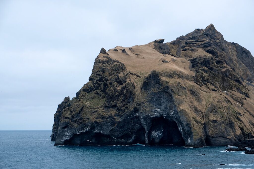
The volcanic activity that has now ceased is associated with the Eyjafjallajökull area on Iceland’s South Coast — one of the country’s most watched volcanic systems. Eyjafjallajökull sits roughly 125 kilometres southeast of Reykjavík and is best known internationally for its 2010 eruption, which shut down European airspace for weeks. The Westman Islands, an archipelago located about 10 kilometres off Iceland’s South Coast, sit in close proximity to this volatile volcanic zone. Reports from Morgunblaðið indicate the skies over Eyjum — the local shorthand for the Westman Islands — have cleared, a reliable visual indicator that eruptive activity has subsided.
Iceland straddles the Mid-Atlantic Ridge, where the North American and Eurasian tectonic plates pull apart. This makes the country one of the most volcanically active places on Earth. The Eyjafjallajökull system is one of several active volcanic zones on the South Coast, alongside Katla and the Reykjanes Peninsula, which has seen repeated eruptions since 2021.
Is it safe to travel to the Westman Islands area now?
Conditions have improved significantly, and the end of eruptive activity is a positive development for travellers. However, safety assessments move through official channels before full public access is confirmed. The Icelandic Department of Civil Protection and Emergency Management (Almannavarnir) is the authoritative source for travel safety zones and road closures around volcanic areas.
For travellers already on the South Coast or planning a visit, these are the practical steps to take right now:
- Check Almannavarnir’s official website for updated hazard zone maps before driving toward the eruption site.
- Monitor the Icelandic Meteorological Office (Veðurstofan) for air quality and ash fall updates.
- Contact the Westman Islands ferry operator, Herjólfur, for the latest sailing schedule — crossings from Landeyjahöfn take approximately 35 minutes.
- If staying in the area, confirm with your accommodation that roads are passable. Route 1, the Ring Road, is the main artery for this region.
As a general guide, the Westman Islands themselves are a resilient community. Locals on Heimaey — the only inhabited island in the archipelago — are well accustomed to living alongside volcanic risk. The island’s famous volcanic museum, Eldheimar, documents the 1973 eruption that buried a third of the town under lava and ash. Residents there are practical and informative, and local advice from the tourism office on Skólavegur is worth seeking if you are already on the island.
How long did the latest Iceland eruption last?
The precise start date of this specific eruptive episode has not been independently confirmed at the time of writing. Iceland has experienced a heightened period of volcanic activity since the Reykjanes Peninsula began erupting in December 2023, with multiple fissure eruptions occurring in rapid succession near Grindavík. Activity in the broader South Coast and Eyjafjallajökull area has been monitored closely throughout this period. Officials have not yet released a full duration figure for this latest episode, but Veðurstofan and the University of Iceland’s Institute of Earth Sciences (Jarðvísindastofnun Háskóla Íslands) are the bodies most likely to publish a formal timeline. This article will be updated as that data becomes available.
What does the end of the eruption mean for flights and travel?
Ash clouds from Icelandic eruptions can disrupt air travel across the North Atlantic and into European airspace — as the 2010 Eyjafjallajökull eruption demonstrated when it grounded an estimated 100,000 flights across the continent. So far, reports indicate this most recent episode did not produce a comparable ash cloud. However, ISAVIA, Iceland’s air navigation service provider, monitors volcanic ash in real time and issues NOTAMs (Notices to Air Missions) whenever airspace safety is affected.
Keflavík International Airport (KEF), which handles the vast majority of Iceland’s international flights, operates approximately 45 kilometres southwest of Reykjavík. Domestic flights serving Vestmannaeyjar Airport (VEY) on Heimaey are operated by Eagle Air (Ernir) and are among the first services affected when ash is present in lower atmosphere. With the eruption now over and skies clearing, disruption to both domestic and international routes is expected to ease rapidly.
Travellers should:
- Check directly with their airline or Icelandair for any outstanding schedule changes.
- Review ISAVIA’s real-time airspace status at isavia.is before travel to or from Iceland.
- Allow extra time at KEF if arriving during the immediate post-eruption period, as air traffic may still be catching up with earlier delays.
Will there be another eruption soon in the same area?
Iceland’s volcanic systems do not follow predictable schedules, and geologists are careful not to give firm timelines. That said, the Eyjafjallajökull volcanic system historically erupts less frequently than the nearby Katla system, which has not had a major eruption since 1918 and is considered overdue by some volcanologists. The two systems are geologically linked — the 2010 Eyjafjallajökull eruption raised concern that it could trigger Katla, though that did not occur.
On the Reykjanes Peninsula, the pattern of frequent, relatively short eruptions near Grindavík and Svartsengi has continued since 2023, and scientists from Veðurstofan have noted that this activity cycle may persist for years or even decades. The South Coast volcanic zone, while separate, operates under similar geological pressures along the rift system.
In short: the eruption near the Westman Islands has ended, but Iceland remains geologically dynamic. Visitors should treat volcanic risk as a permanent background condition when travelling in the country’s southern regions, not an exceptional event to be alarmed by. Monitoring tools are excellent and publicly accessible, and Iceland’s civil protection infrastructure is among the most capable in the world for managing this kind of natural hazard.
Practical information for travellers heading to the South Coast
For those planning to visit the Westman Islands or drive Iceland’s South Coast in the coming days, conditions are improving. The ferry to Heimaey departs from Landeyjahöfn harbour — a short detour off Route 1, approximately 180 kilometres from Reykjavík. The crossing takes around 35 minutes in calm weather. Tickets can be booked online via herjolfur.is. A return adult fare typically runs around 2,600 ISK one way.
On the island, Eldheimar museum on Gerðisbraut remains one of the most compelling volcano-related experiences in Iceland — the preserved houses buried in the 1973 eruption are visible beneath the lava. Entry is around 2,800 ISK for adults. The island’s puffin colony, one of the largest Atlantic puffin breeding sites in the world, is also a major draw in season.
Accommodation on Heimaey is limited but reliable. Gisting Heimir on Heiðarvegur and the Ára Guesthouse are frequently recommended options, and booking ahead is advisable, particularly in summer. For real-time road conditions anywhere in Iceland, use Vegagerðin’s 112.is app or road.is — both are essential tools for South Coast driving.
Frequently asked questions
Has the Iceland eruption near the Westman Islands completely stopped?
Reports from Morgunblaðið confirm that clear skies have returned over Vestmannaeyjar, indicating that eruptive activity has ceased. Icelandic authorities, including Almannavarnir and Veðurstofan, will issue formal updates confirming the end of the eruption phase. Travellers should continue to monitor official channels, as post-eruption volcanic unrest can occasionally resume.
Can I still visit Heimaey in the Westman Islands?
Heimaey remains one of Iceland’s most rewarding destinations, and the end of eruption activity removes the primary concern for most visitors. The Herjólfur ferry from Landeyjahöfn runs year-round and takes roughly 35 minutes. Check current sailing times and any temporary closures on herjolfur.is before travelling.
Did this eruption affect flights to Iceland?
This eruption does not appear to have caused the kind of large-scale airspace closure seen during the 2010 Eyjafjallajökull event. Domestic flights to Vestmannaeyjar Airport may have experienced temporary disruption. Travellers should confirm their flight status with their carrier and check ISAVIA’s airspace updates at isavia.is.
Is Iceland’s South Coast safe to drive right now?
The South Coast is generally accessible, but road conditions near active or recently active volcanic zones can change quickly. Use Vegagerðin’s official road condition site at road.is or the 112.is app for live updates. Some F-roads and access tracks near the eruption site may remain closed until authorities confirm they are safe.
How often does Iceland experience volcanic eruptions?
Iceland averages a volcanic eruption roughly every four to five years historically, though the current Reykjanes Peninsula cycle has dramatically increased frequency since 2021. The country has around 30 active volcanic systems. Eruptions range from small, brief fissure events to major explosive episodes capable of affecting European airspace.