


- The flood is receding, with water levels and conductivity in Skálm nearing normal readings.
- The flood peaked the evening before last.
- Specialists from the Icelandic Meteorological Office are continuing their observation in the area.
Over the past 24 hours, water levels at the Icelandic Meteorological Office’s gauging station in Skálm, by the highway, have been falling steadily back toward normal. Seismic sensors on nunataks in the Mýrdalsjökull ice cap are also showing a marked drop in tremor activity. A live feed from Rjúpnafell confirms that the water volume in Leirá Syðri has come down noticeably since yesterday — all signs that the glacial outburst flood is winding down.
Figure 1: Water level variations in the Skálm River alongside the highway over the past week (July 5–11). The upward trend began on July 8 as floodwaters began pouring into the river.
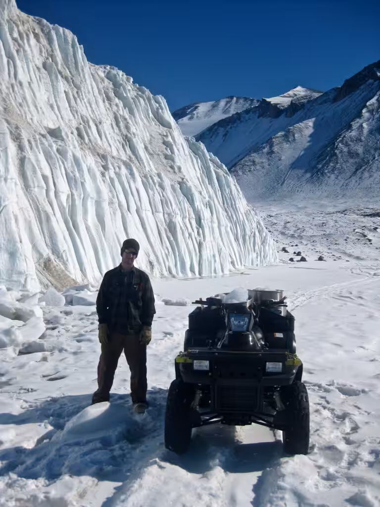
Figure 2: Conductivity levels in Skálm by the highway over the last week (July 5–11).
In Leirá Syðri, conductivity is dropping but water levels have actually crept up — most likely because sediment is piling up in the riverbed, raising the channel floor and pushing the water surface higher as a result.
Residents and travelers may still notice a sulfur smell in the area. Stay well clear of the riverbanks until conditions fully normalise.
Updated July 10, 2025
Through the night into July 10th, conductivity and water levels in both Leirá Syðri and Skálm continued to climb. By the morning of July 10th they had begun to turn around, which tells us that Leirá peaked on the evening of July 9th and Skálm reached its high point at the Highway 1 bridge on July 10th. Seismic tremors at Austmannsbunga have also been low since the morning of July 10th.
The flood looks set to keep retreating, with discharge expected to settle back to typical summer levels. That said, there is still a chance of sudden boiling in geothermal systems beneath the glacier — triggered by pressure release from the flood itself — which could melt more ice and push runoff back up.
Right now it is hard to predict exactly how things will develop. The Icelandic Meteorological Office has round-the-clock monitoring in place and is tracking every change as it happens.
Figure 1: Water levels in upper Leirá Syðri from July 7 to 14:00 on July 10.
Possible Origins of the Flood
This flood most likely originated from geothermal cauldrons in Mýrdalsjökull, south of Austmannsbunga — specifically cauldrons 13 and 14 in the Kötlukettle numbering system. Those same cauldrons triggered a significant flood in July of last year. Ice radar measurements carried out in May by Eyjólfur Magnússon from the Institute of Earth Sciences at the University of Iceland had already flagged a considerable build-up of water beneath them at the glacier’s base, which could well explain what is happening now. No confirmation has come through yet of any changes to the glacier surface in those areas, so some uncertainty remains. Remote sensing data over the coming days — along with any pilot reports from flights over the region — should help clarify the picture.
Figure 2: Map illustrating the locations of monitoring instruments around Mýrdalsjökull and the path of Leirá Syðri in Skálm.
Notices of Sulfur Odors and Travel Advisories
The Icelandic Meteorological Office has had several reports of sulfur odors near Skálm. Gas pollution is a real possibility in the area, so keep a safe distance from the riverbanks at all times.
Since July 8, close to 100 earthquakes have been recorded in Mýrdalsjökull, the largest a magnitude 2.7 at 7:00 AM on July 10. Larger quakes are still possible, so anyone in the vicinity of the glacier should remain alert.
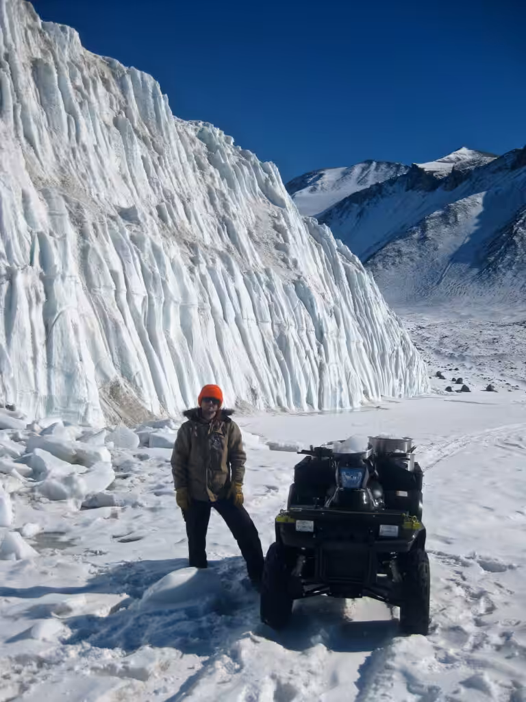
Figure 3: Specialists from the Icelandic Meteorological Office conducting measurements at Skálm on July 9. Photo: Njáll Fannar Reynisson.
Additional Observations in Fremri-Emstruá
Alongside the flooding in Leirá and Skálm, there are reports of rising water in Fremri-Emstruá too. This appears to be an entirely separate event — flooding in that river is fairly routine between late June and early August and has not historically caused damage or serious hazards, other than possible gas emissions close to where the river meets the glacier. Travelers should still give Fremri-Emstruá and the edge of Entujökull a wide berth.
Updated July 9, 2025
Fresh readings from a new monitoring instrument in front of Sandfellsjökull show rising conductivity and water levels in Leirá Syðri. Elevated readings are also coming in at the Highway 1 bridge over Skálm, as Leirá Syðri feeds into Skálm further upstream.
At this point the event is being classed as a minor flood, though both water levels and conductivity are still gradually climbing.
Sulfur odor reports have led the Icelandic Meteorological Office to urge caution near the river source, where gas pollution may still linger. As always, keep well away from river channels.
The Icelandic Meteorological Office will keep monitoring the situation and issue further updates as things develop.
Water Level Changes in Upper Leirá Syðri from July 7 to 15:00 on July 9.
Diverse Sizes of Glacial Floods from Mýrdalsjökull into Leirá
Floods fed by geothermal activity beneath the glacier are not unusual in several rivers draining Mýrdalsjökull, including Múlakvísl and Fremri-Emstruá.
Leirá itself has seen floods of many different sizes over the years. Annual flooding was recorded between 1995 and 2000, and a minor event hit in 2012. The main consequence of these floods has been sediment deposition that built up the Leirá alluvial fan south of Sandfell, eventually pushing the river’s southern channel in a new direction — not structural damage.
Last summer, what started as a minor flood in Leirá Syðri and Skálm at the end of July escalated unexpectedly into a major event that overflowed and damaged parts of Highway 1. That large flood was traced back to two cauldrons in Mýrdalsjökull.
Since the substantial July 2024 flood, four smaller floods have occurred in the river, none causing any damage. The last of those was recorded in December.
“The precise causes of last year’s major flood remain elusive,” notes Bergur Einarsson, Head of Hydrology at the Icelandic Meteorological Office. “If boiling in geothermal systems beneath the glacier—triggered by a minor glacial flood—was indeed responsible for the major flood last year, then current events could similarly result in an escalation of flooding. We must also remain vigilant, as recent ice radar measurements show substantial water accumulation at the glacier’s base,” he adds.


